|
Saturday January 20 &
27,
2018 A two week period of abnormally cold weather with daytime temperatures in the teens and nighttime temperatures near or below zero resulted in area rivers and lakes to become covered in ice. This period of cold weather was then quickly followed by a January thaw with above normal temperatures and a period of heavy rainfall. Large areas of river ice broke free and created ice jams at various points farther south. A favored area for ice jams occurs near the sharp bend in the river near the towns of Columbia and Wrightsville where the river separates Lancaster and York Counties. A week after these ice flows occurred there were still massive ice jams in this area and numerous ice slabs piled on top of one another as shown in the following photographs.
Open Water - Marietta Riverfront Park: This scene was photographed about 4 miles north of the town of Marietta looking downstream at mostly open water with patches of river ice. These free flowing ice slabs would soon be piling up at an ice dam near a sharp bend in the river.
Ice Blocks - Marietta Pennyslvania: These ice blocks are not visibly moving and have become lodged in an ice jam just north of the town of Marietta. Water is flowing below the ice from right to left in this view looking towards the west bank of the Susquehanna.
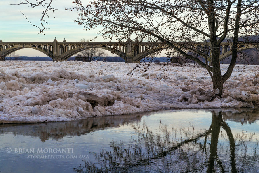
Wrightsville Bridge - West Bank Susquehanna: Standing on the west bank of the river looking downstream (south) towards the bridge that connects Columbia and Wrightsville. At some places near the shore open water could be found, while at other places ice slabs are thrust upon the shoreline.
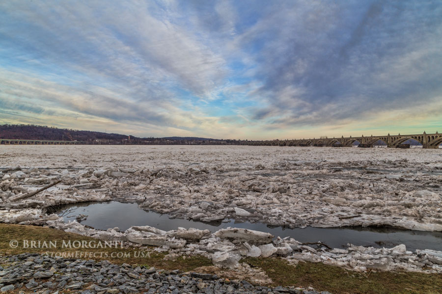
River View - Highway 30 & Wrightsville Bridges: This wide angle view is looking east across the river towards Columbia, Lancaster County. The river is about a mile wide at this point and both the Route 30 bridge on the left and the Wrightsville bridge on the right are visible.
Icy Shoreline - Wrightsville, PA: Looking north toward the Route 30 bridge crossing from the west bank of the Susquehanna. Here ice blocks can be seen piling up against the shoreline.
Wrightsville Bridge View - Wrightsville, PA: Here is a wider angle view of the Wrightsville Bridge looking downstream from the west bank of the Susquehanna. Debris such as tires, barrels, and furniture are mixed in with the ice and evident everywhere. Notice a patch of flowing water between the ice jams.
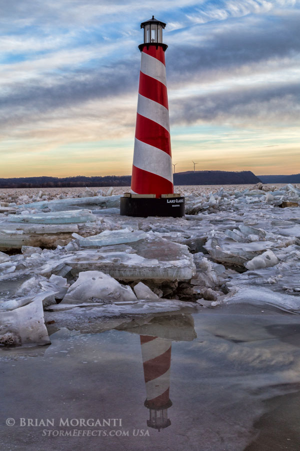
Lake Clark Marina - Susquehanna River: A tree and lighthouse became surrounded by ice when the river overflowed its banks carrying huge slabs of ice on shore.
Lake Clark Marina - Lighthouse: Another view of the marina's lighthouse as it is being reflected in melt water near the shoreline.
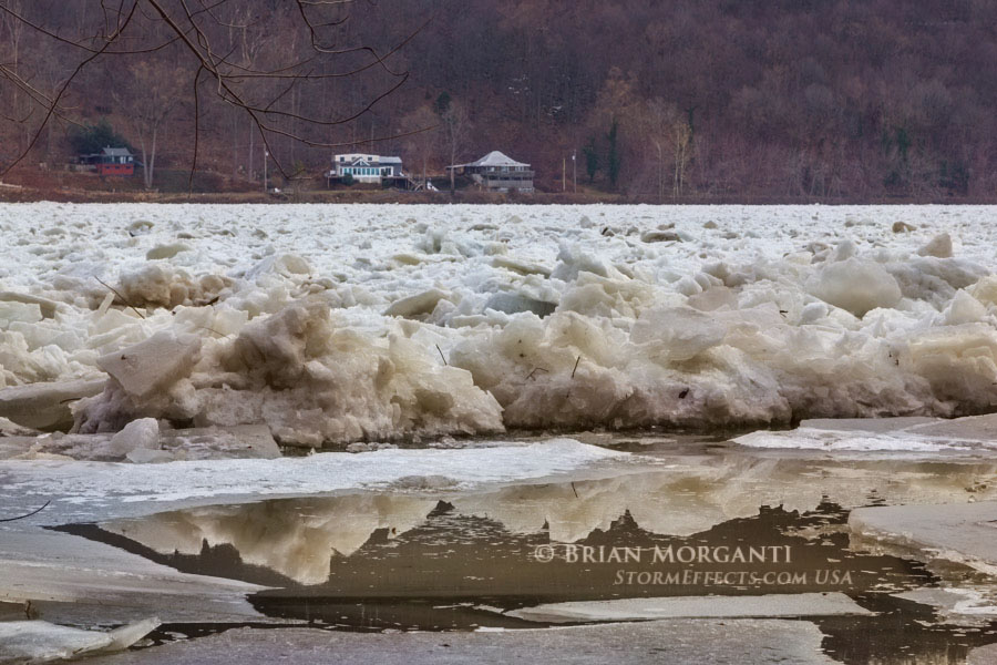
Ice Slab Pile Up: These slabs of river ice were pushed up on shore earlier in the week when the ice jams broke free during warmer weather.
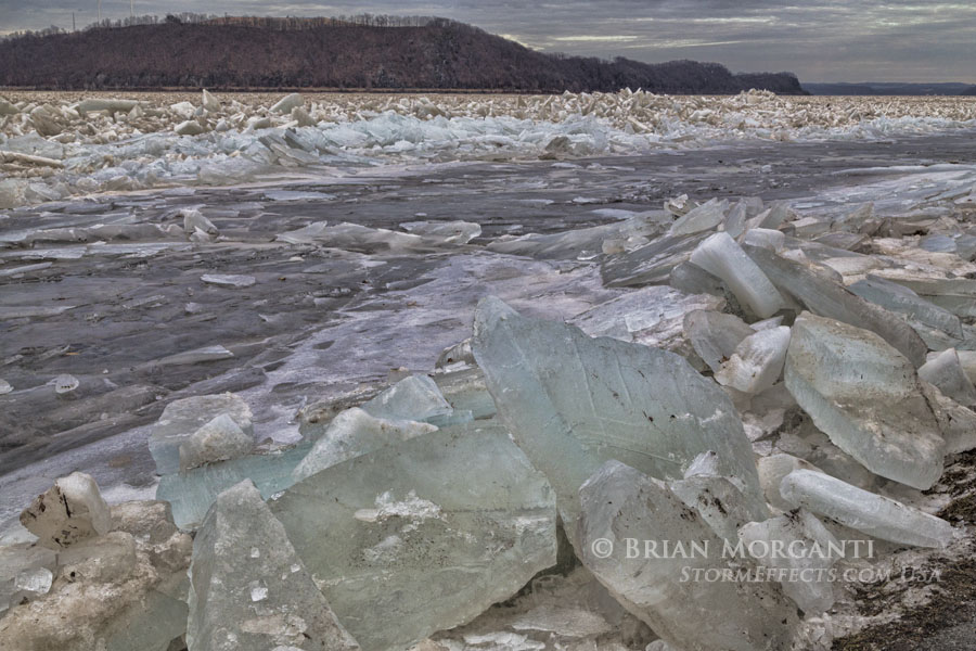
Blue Ice Slabs - South of Wrightsville, PA: A giant pile of ice slabs pile up onshore near a picnic grove along the west bank of the Susquehanna River. A young tree is no match for the crushing weight of the ice.
Cracked Ice Slabs - South of Wrightsville: A large amount of river ice along the west bank of the river.
Tree surrounded by Ice: One of the many trees along the river shoreline that were overtaken by river ice being pushed up on shore. The following images were taken 1 week later...
No Swimming - No Kidding!: A tangled mess of logs, debris, and ice looking east towards the Lancaster County border.
Grandson Colin - Downstream River Ice: Looking south along Bull Run Road just off 624 where river levels are being closely monitored.
Blocks of Ice Everywhere: Ice blocks are piled high both on shore and mid-river just below the Lake Clarke area.
Melt & Refreeze: An area of free flowing water just off shore has frozen over once again as temperatures fluctuate day to day.
|


A